HomeWhat we doGeological consultancy & resource evaluation

Geological consultancy & resource evaluation

Mapping, sampling, structural interpretation and resource evaluation on your ground — delivered as a report you can put in front of a bank, not a slide deck.

Field mappingSampling & QA/QCResource estimationSecond opinions
The work

A number, and what it is worth.

A resource figure without its assumptions is a rumour. Our reports carry the sampling method, the QA/QC results, the estimation parameters and the limitations, so a reader who disagrees with us can see exactly where they disagree.

That makes the reports longer and occasionally less flattering. It also makes them usable in front of a lender, a partner or a regulator, which is the only reason to commission one.

We also take second opinions on work someone else has done. Those are quoted as a fixed fee and delivered whether or not the conclusion suits the person who commissioned them.

Field mapping and structural logging
Sampling programmes with QA/QC
Resource estimation and reporting
Independent second opinions
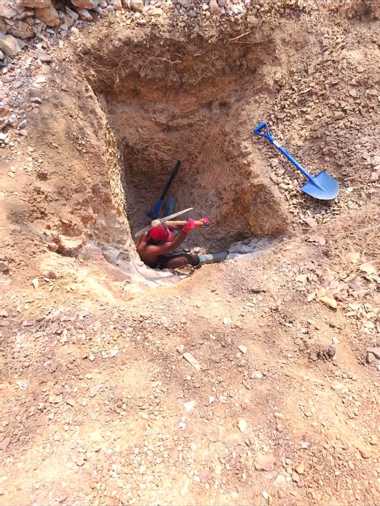
Costean cut by hand, exposing the contact before any machine moves
Deliverables

What you actually receive.

Every engagement produces documents, not a conversation. The list below is what leaves our office at the end of a standard evaluation.

Geological mapLithology, structure and alteration at a stated scale, georeferenced, with the traverse lines that produced it shown rather than hidden.
Sampling reportMethod, sample density, chain of custody and the QA/QC results including blanks, duplicates and standards.
Structural interpretationThe controls on mineralisation as we read them, with the confidence in that reading stated section by section.
Resource statementTonnage and grade by category with the estimation method, cut-off and search parameters written down.
LimitationsWhat the data cannot support. This section is not optional and it is not moved to an appendix.
RecommendationWhat we would spend next and what we would not, with an indicative cost for each.
Programme

Desk to signed report.

Typical elapsed time for a licence-scale evaluation is six to ten weeks, most of it in the laboratory rather than the field.

01

Desk study

Existing data, cadastre, imagery and regional geology. Occasionally this stage alone answers the question and the programme stops.

02

Field

Mapping, costeaning and sampling to a designed density, with QA/QC inserted at the point of sampling rather than afterwards.

03

Laboratory

Sample preparation and assay at an independent laboratory. We do not run our own assays for our own reports.

04

Report

Estimation, interpretation and the written report, issued as a signed document with the underlying data appended.

Terms

The commercial detail.

Stated here so that the first conversation can be about the work rather than about how we charge for it.

ItemDetail
Typical durationSix to ten weeks for a licence-scale evaluation
BasisFixed fee against a written scope; laboratory costs at cost, shown separately
LaboratoryIndependent, accredited, named in the report
Data returnedAll raw data, in the original format, whatever the conclusion
ConfidentialityNon-disclosure signed before the desk study begins
Second opinionsFixed fee, two to three weeks, delivered as written
Questions

Asked often enough.

Will you write a report that says the ground is not worth working?

Yes, and we have. The fee is for the work, not for a conclusion. A report that only ever agrees with its client has no value to the bank the client wants to show it to.

Do you use your own laboratory?

No. Assays for our reports go to an independent accredited laboratory, named in the report, precisely so that the number is not ours to influence.

Can you review work another consultant has done?

That is a common instruction. We will state clearly where we agree, where we do not, and which parts of the original work we could not verify from the data provided.

Who owns the data?

You do, including the raw assay files. It is returned at the end of the engagement regardless of the outcome or the state of the invoice.

Next step

Get the ground properly assessed.

Send the licence and whatever data already exists. We will scope the programme, price it as a fixed fee, and tell you what the existing data can and cannot support before you spend anything.

What we need from you
Licence number and boundary
Existing sampling, mapping or drilling data
What decision the report has to support
Deadline, and who the report is for